Central Coast Itinerary – PCH & Santa Lucia Mountains
The north end
of the Santa Lucia Range is Carmel but Monterey is a great starting point.
Stay in Pacific
Grove for a long term visit.
Day
One: Monterey
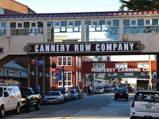
Monterey is home to one of the
most impressive tourist attractions, the Monterey Bay Aquarium. Located
on Cannery Row, the aquarium is home to more than 35,000 animals and
plants. Other popular attractions include the Old Fisherman’s Wharf and
the breathtaking Point Lobos State Natural Reserve. And definitely make sure you take the time to enjoy the
unforgettable 17-Mile Drive (Carmel-by-the-Sea), where you’ll see stunning
views of the coastline, the famed Pebble Beach golf course, and have access to
gorgeous beaches in Pebble Beach.
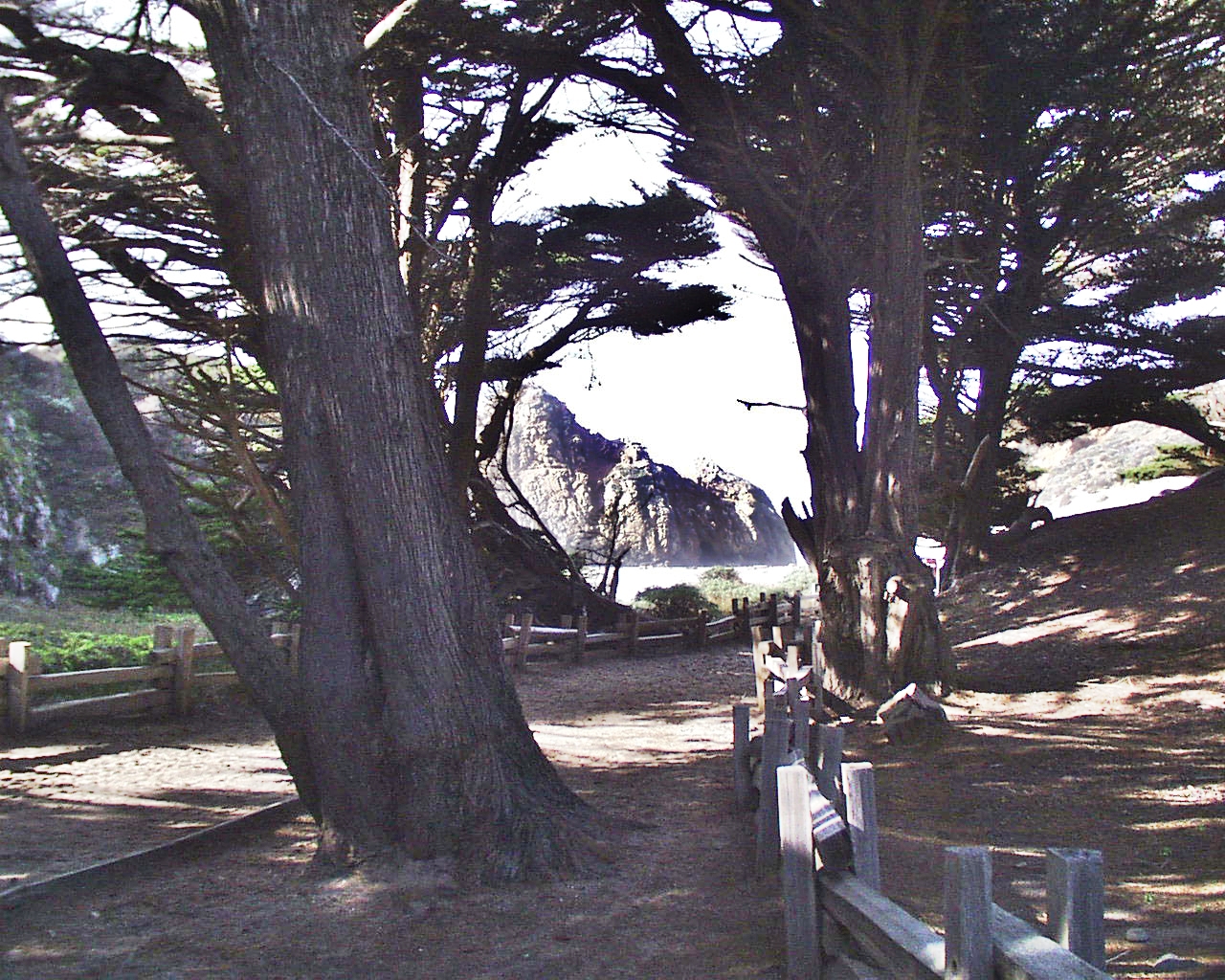
Day Two: Big Sur south into north San Luis Obispo County
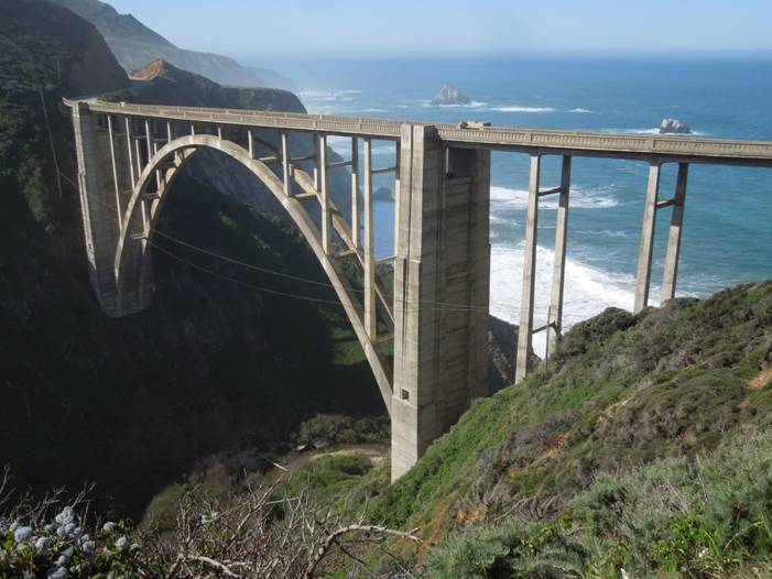
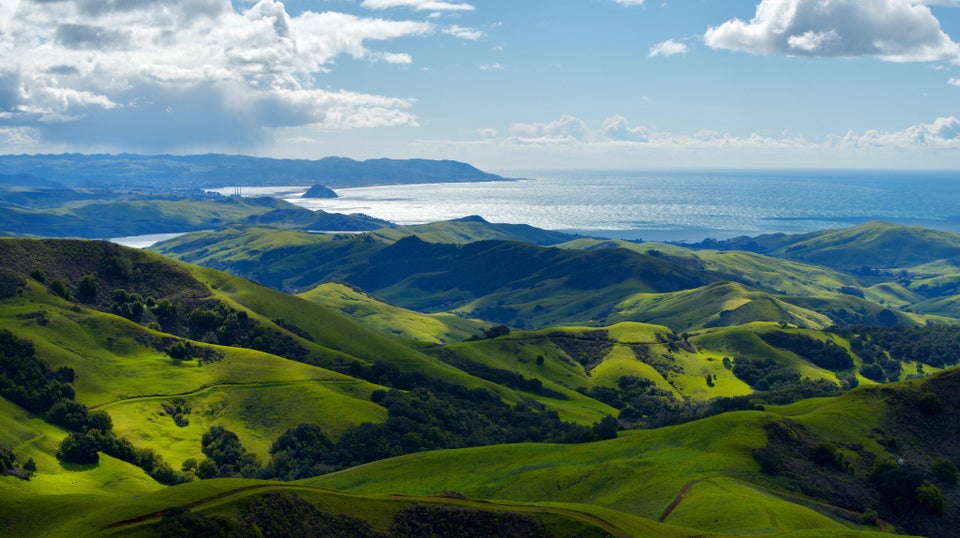
The Santa Lucia Range is never more
than about 10 miles from the Pacific, but it comes right down to the ocean in Big Sur. Bixby Bridge is an icon for Big Sur and the California
coast.
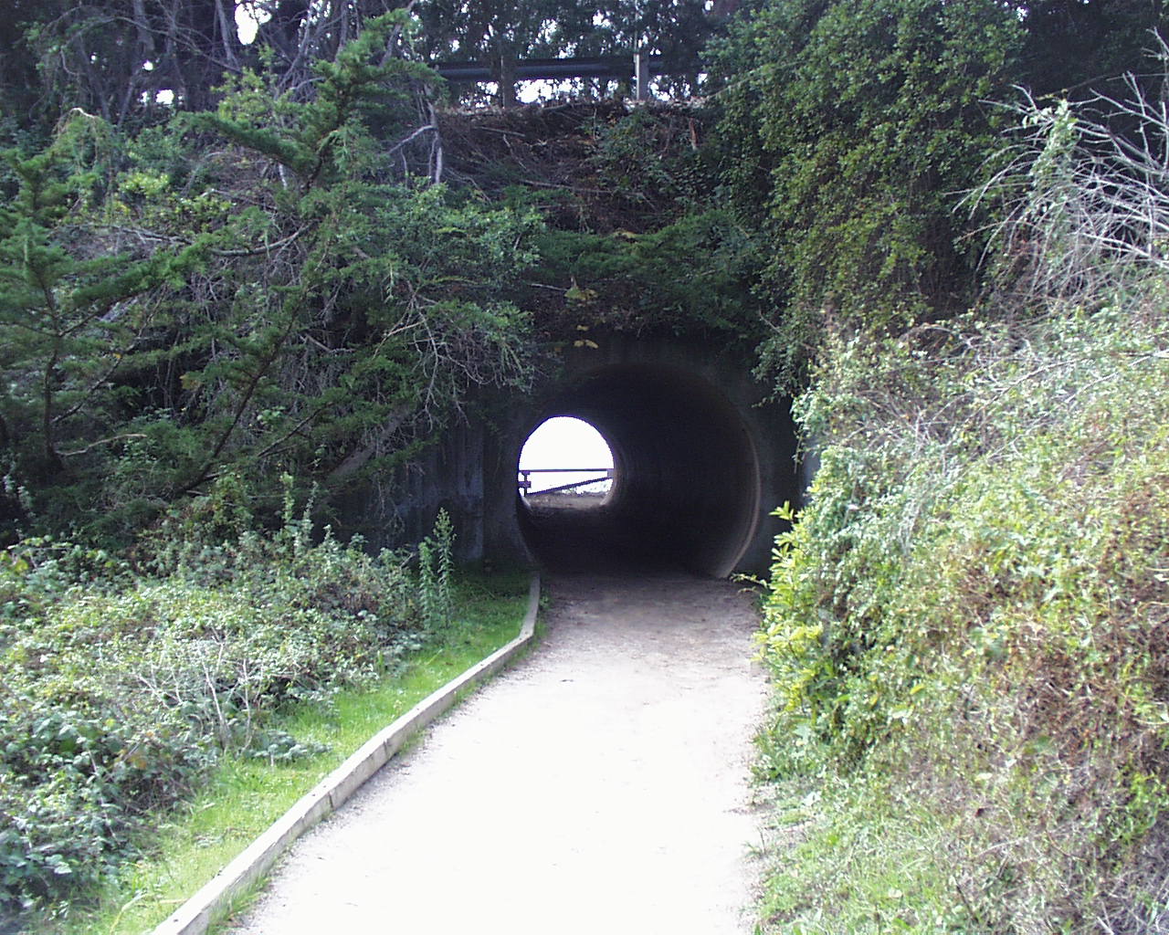
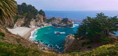
Walk thru the tunnel under PCH (Hwy 1) to see 1 of only 2 California waterfalls
that actually dump into the Pacific, McWay
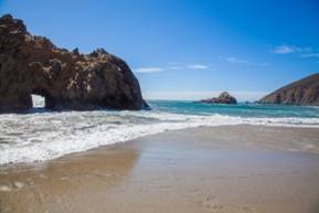
Falls. Also, save time for a short tree-covered walk to
the beautiful Pfeiffer Beach.
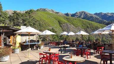
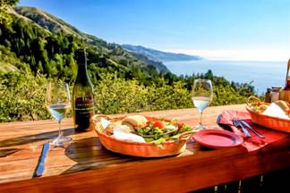
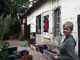
Getting hungry? Try a casual meal at the Cafe Kevah in
Nepenthe, right off Hwy 1.
You’ll get a combination mountain/coastal view to remember!
There are many other
Big Sur spots to experience, but you’ll need more
time!
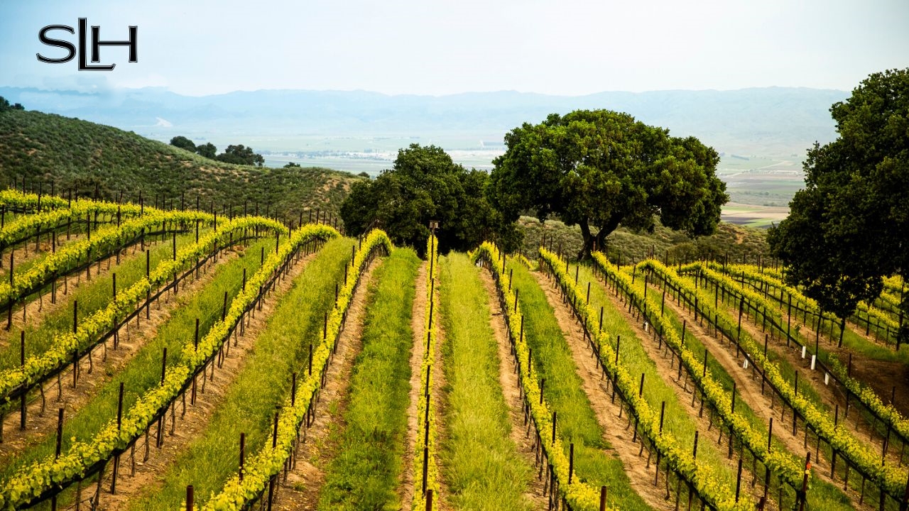
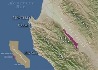
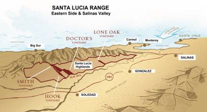
The inland, eastern part of the
Santa Lucia Range (here) borders the Salinas Valley (Hwy 101). The map below
shows the Santa
Lucia Highlands (SLH in purple) on the western side
of the valley, but Hwy 101 is another road trip!
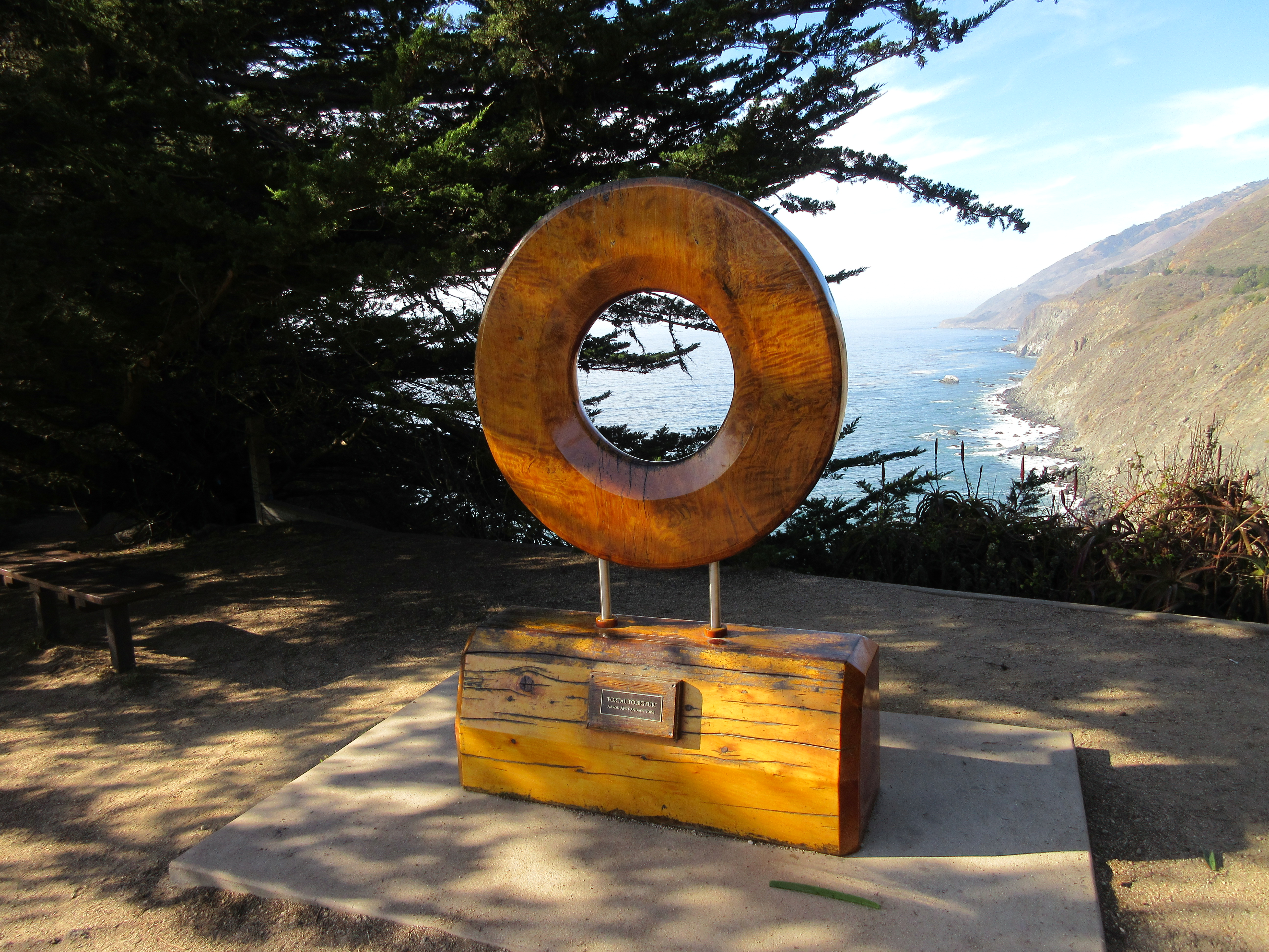
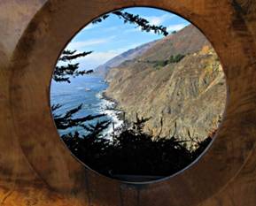
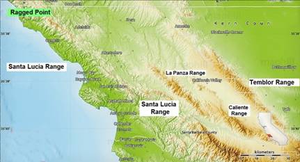
At the end of Big Sur is Ragged
Point. There’s even a piece of beautiful artwork there to let
you get one last look at the Big Sur coast. The Santa Lucia Range still follows
the coast south thru San Luis Obispo County but doesn’t have that dramatic drop
off into the Pacific Ocean
Day Three: Paso Robles to the Santa Barbara
County Line
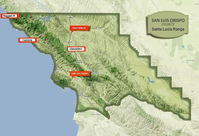
Continue south along the coast. Pass
Cambria and take Hwy 46 (near Harmony, pop. 18) inland
to get back to the
Santa Lucia Range. Continue to Paso Robles on the
eastern side of the Santa Lucia Range. Pickup Hwy 101 and take it south past
Atascadero. As you go down Cuesta Grade to San Luis Obispo, you’ll pass back to
the western side of the Santa Lucia Range. *Fun
Fact re Cuesta Grade: Since ‘cuesta’ means ‘slope’, the translation is: “slope
slope” which recalls the Italian restaurant in “Mickey Blue Eyes” named “The La
Trattoria” or “the the trattoria”. You haven’t seen that Hugh Grant movie???
Your road trip from SLO continues
back to the coast thru Pismo Beach, then south thru Arroyo Grande. The southern
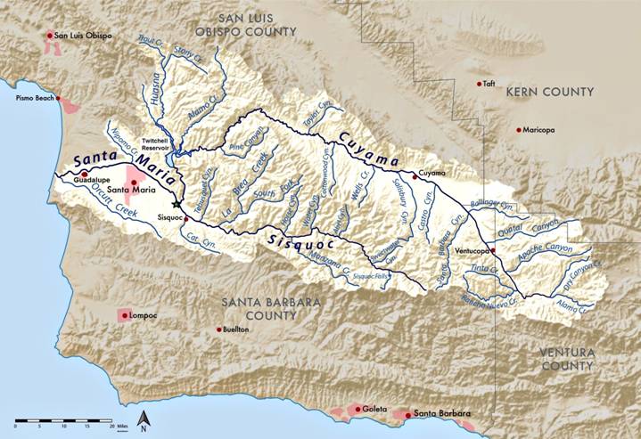
border of San Luis Obispo roughly follows the Santa Maria River backward from
the ocean staying north of Guadalupe. When it reaches the confluence of the
Cuyama River and the Siquoc River just southeast of Santa Maria (see the green
star below), this border then follows the Cuyama River north (splitting the
Twitchell Reservoir) then east. The SLO County border leaves the Cuyama river
and goes to the SE corner of SLO County. (Don’t ask me how they decided on that
4 (or 5?) county “corner”!)
That’s the end
of my “Virtual Central Coast Tour of the Santa Lucia Range”!
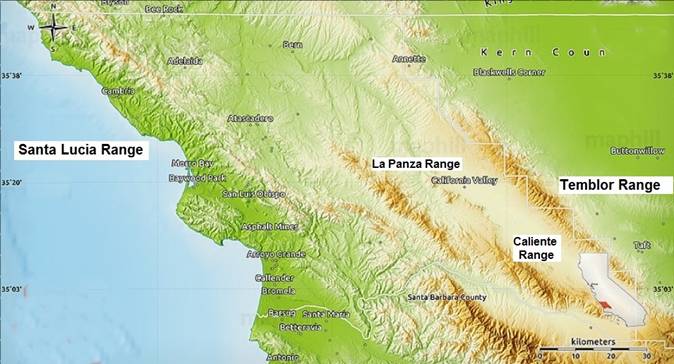
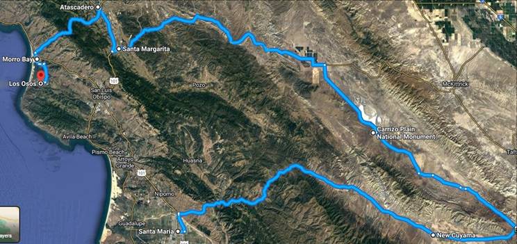
Of course, you could continue on Hwy
166 east past New Cayuma… Turn north toward the Carrizo
Plain National Monument and the Temblor Mountains. On your left will be the
Caliente Mountains. Exit north through California City and then head home
(west) thru the La Panza Mountains
and Santa Margarita. Now pickup SR 101 north to Atascadero and take SR 41 thru
(you guessed it!) the Santa Lucia Range down to the coast to Morro Bay and Los
Osos. Your ‘home base’, right??? All 4 SLO County mountain ranges!